Mattapoisett, MA Online GIS Hosting Services
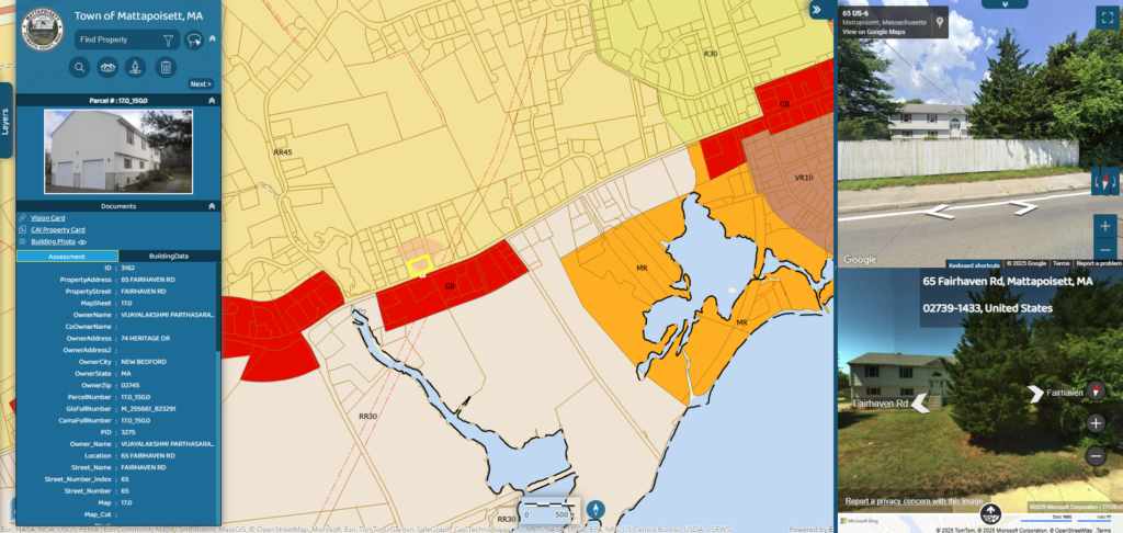
Mattapoisett, MA has contracted with CAI to host the Town’s GIS data using our AxisGIS platform. AxisGIS is an advanced but yet simple and easy to use web based GIS […]
Hermon, ME Online GIS Service
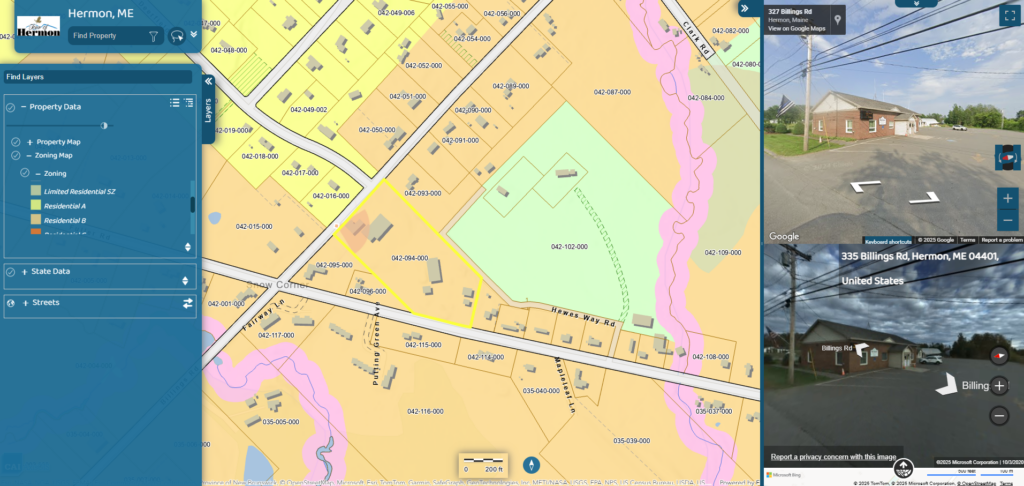
Hermon, ME has contracted with CAI to host the Town’s GIS data using our AxisGIS platform. AxisGIS is an advanced but yet simple and easy to use web based GIS […]
Lowell, MA Online GIS Hosting Service
CAI Technologies is proud to announce that Lowell, MA has selected us to provide our AxisGIS PRO Service. AxisGIS will replace the City’s existing GIS Viewer solution. AxisGIS is Software as […]
Medfield, MA Online GIS Hosting Services

Medfield, MA has in the past hired CAI Technologies to provide Tax Map data maintenance services. Most recently the Town contracted with CAI to host their GIS data on our […]
Saco, ME GIS Conversion, Maintenance and Online Hosting

Saco, ME hired CAI to migrate their existing Tax Map data into our standardized geodatabase maintenance data model. Having the GIS parcel data in the CAI maintenance data model allows […]
Sheldon, VT GIS Conversion and Tax Map Updates

The Town of Sheldon, VT has contracted with CAI Technologies to perform GIS data conversion and Tax Map maintenance services. CAI shall convert existing AutoCAD Tax Map data into a […]