Town of Hudson, Maine Selects CAI for Online GIS Platform
The Town of Hudson, Maine contracted with CAI to implement the AxisGIS platform. Having completed the project, the Town of Hudson is able to distribute their data with the public […]
Celebrating 40 Years of GIS Solutions and Precision Mapping Excellence

CAI Technologies is proud to celebrate 40 years of delivering local and regional government mapping services and GIS solutions. Since our founding in 1985 as Cartographic Associates, Inc., we have […]
North Kingstown, RI GIS Conversion, Online GIS Hosting and OpenGov Parcel Synching
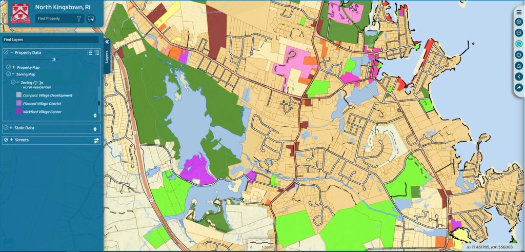
North Kingstown, RI recently hired CAI Technologies to perform a digital conversion of their Tax Maps, implement our online GIS platform and configure GIS data synchronization with their OpenGov and […]
Swanzey, NH Record Research Mapping and Online GIS Data Hosting
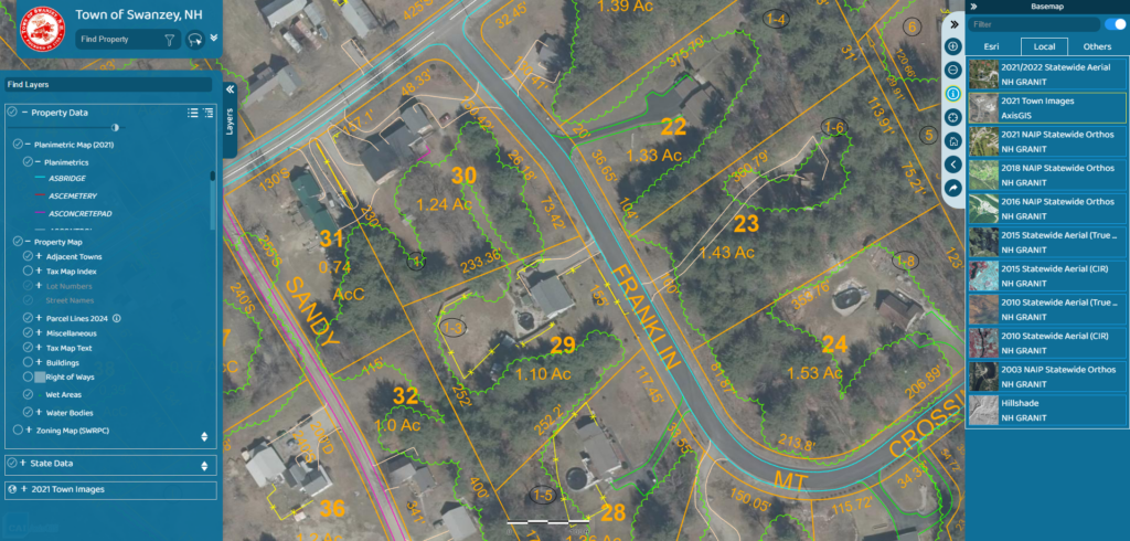
Swanzey, NH – CAI Technologies recently completed a Town wide parcel remapping project. CAI performed record research and recompilation of each of the Town’s parcels using the most recent deed […]
County of Coos, NH Gis Data Conversion & AxisGIS platform
The County of Coos, NH selects CAI to convert their existing AutoCAD data into geodatabase format, perform annual Tax Map updates and host their municipal GIS data online. The conversion […]
Sandwich, NH Record Research Mapping and Online GIS Data Hosting
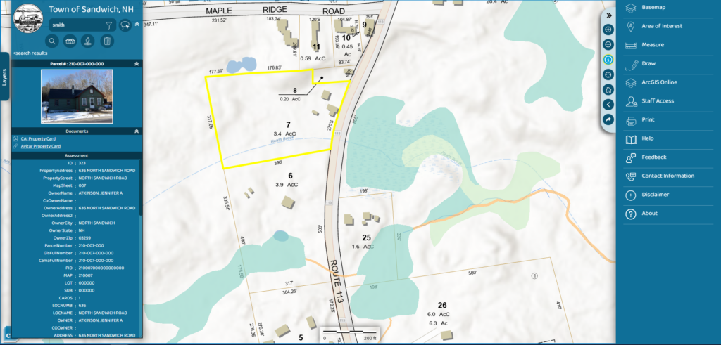
Sandwich, NH – CAI Technologies recently completed a Town wide parcel remapping project. CAI performed record research and recompilation of each of the Town’s parcels using the most recent deed […]