Bar Harbor, ME AxisGIS Pro Service
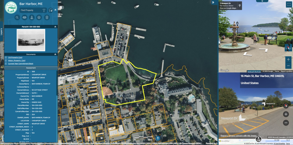
Bar Harbor, ME has selected CAI to provide our AxisGIS PRO Service. AxisGIS will replace the Town’s existing GIS Viewer solution. AxisGIS is Software as a Service (SaaS) that is […]
Ashland, MA Tax Map Maintenance and Online GIS Hosting Services
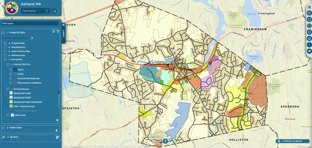
Ashland, MA joins the growing list of communities that CAI provides comprehensive GIS services to. Using deeds and survey plans provided by the Town, CAI will annually update the Town’s […]
Winterport, ME GIS Conversion and Online Hosting
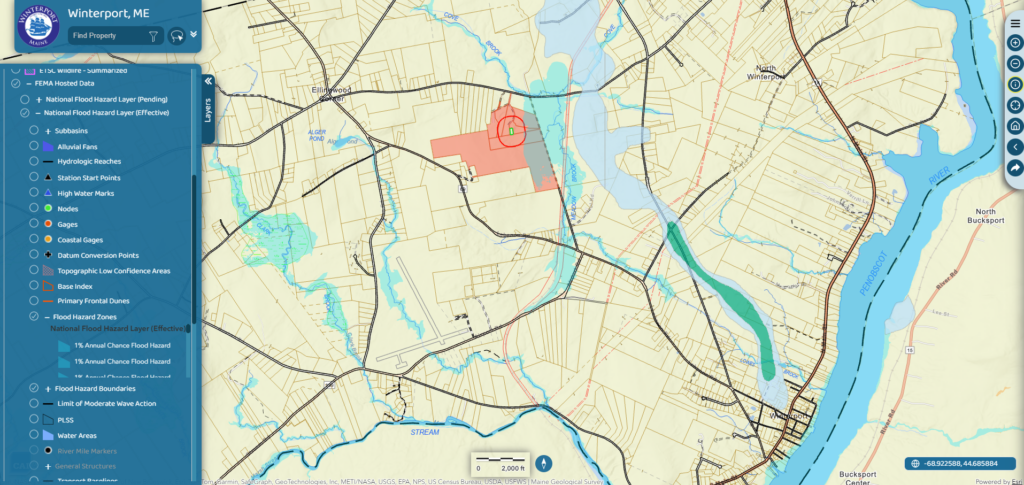
Winterport, ME contracted with CAI Technologies to perform a GIS conversion of their Tax Maps and implement our online GIS platform. CAI began by first digitizing the Town’s existing Tax […]
Medfield, MA Property Tax Calculator
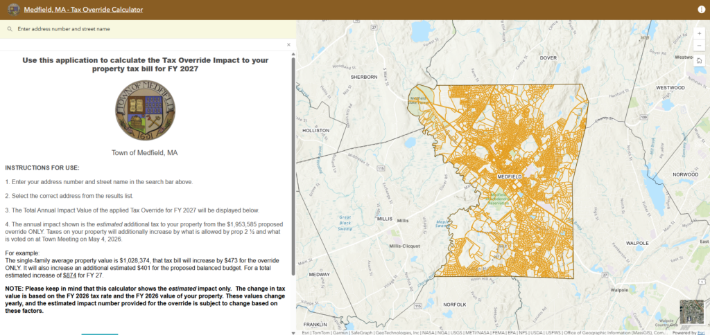
Medfield, MA recently partnered with CAI to configure a Property Tax Calculator. Like many communities, Medfield faces rising costs for education, public safety, and essential services, while revenue growth remains […]
Portsmouth, NH Water Service Tie Card Mapping
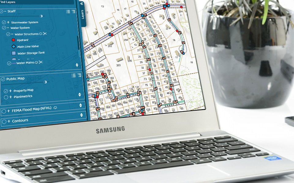
Portsmouth, NH has partnered with CAI Technologies on a crucial infrastructure mapping project to digitize and spatially map vital data from approximately 5,000 historical Water Service Tie Cards. This project […]
Berwick, ME Online GIS Service
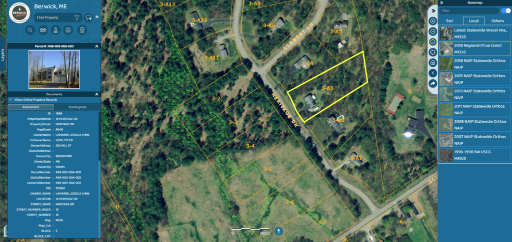
Berwick, ME has contracted with CAI Technologies to host its GIS data on our AxisGIS platform. AxisGIS is an advanced, yet simple and user-friendly, web-based GIS service accessible on any […]