Lancaster, NH Data Conversion, Updates and Online GIS Hosting
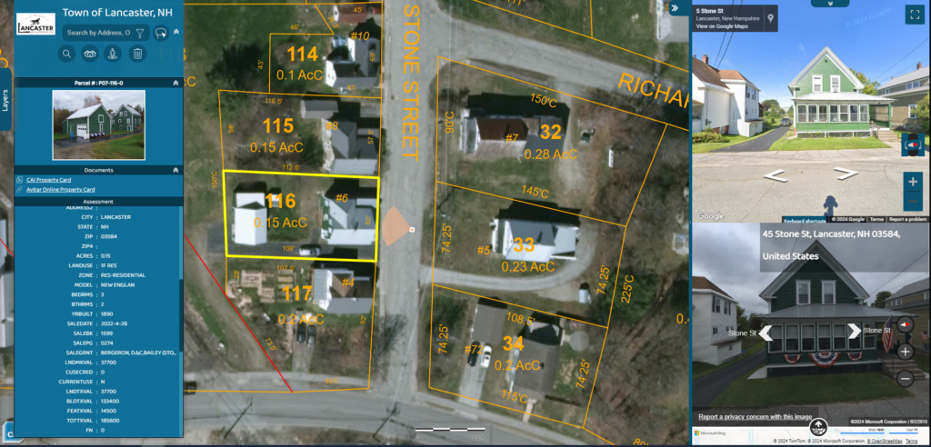
Lancaster, NH hired CAI to migrate their data into our standardized geodatabase maintenance data model. Having the GIS parcel data in the CAI maintenance data model allows CAI staff to […]
Cavendish, VT GIS Conversion, Maintenance and Online GIS Hosting
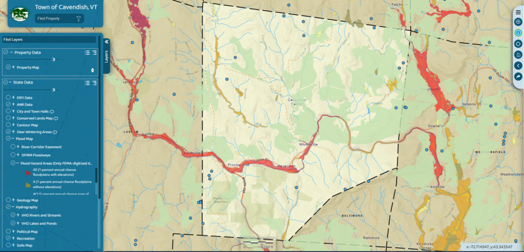
Cavendish, VT contracted with CAI Technologies to provide Geographic Information Systems (GIS) services. Initially, CAI converted the Town’s Tax Maps into our standardized ESRI geodatabase maintenance data model and performed […]
Manchester-by-the-Sea, MA ArcGIS Online HUB Site
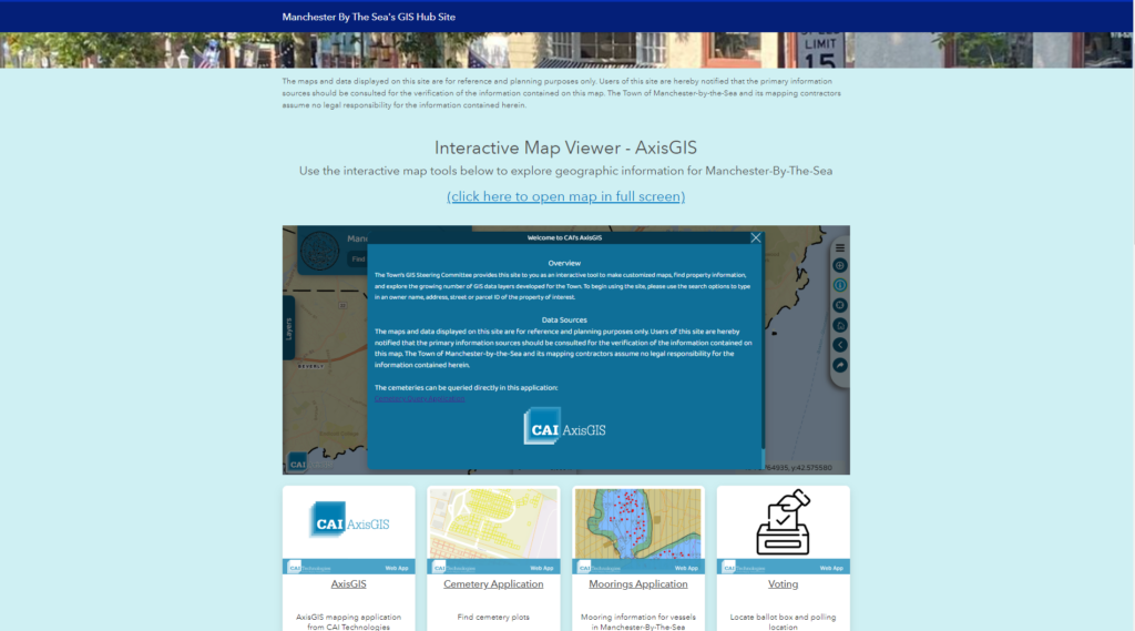
Manchester-by-the-Sea, MA ArcGIS Online (AGOL) Hub site. CAI recently configured an AGOL Hub site for the Town. This webpage is now the landing spot for all things mapping and GIS […]
Warner, NH Tax Map Conversion, Updating and Online GIS Hosting

Warner, NH contracted with CAI Technologies to perform a digital conversion of their Tax Maps, perform a backlog of updates and implement our online GIS platform. CAI began by first […]
West Bradford Township, PA Online GIS Hosting to Support Zoning and Parcel Analysis
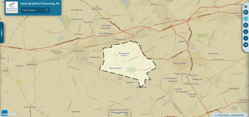
West Bradford Township, PA contracted with CAI to develop a map focused application where taxpayers and potential future residents can search for a property and find out the Zoning allowed/not allowed regulations for […]
Oxford, ME Tax Map Conversion and Online GIS Hosting
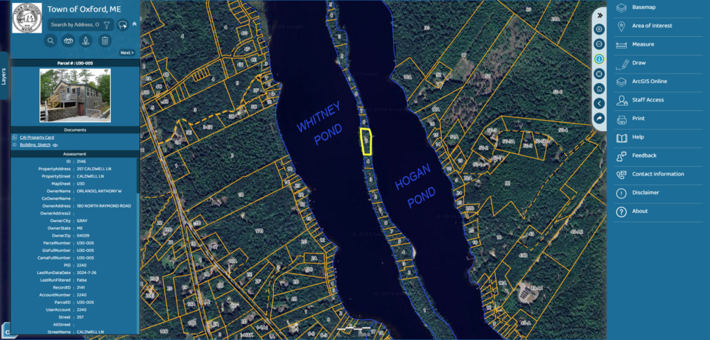
Oxford, ME recently contracted with CAI Technologies to perform a digital conversion of their Tax Maps and implement our online GIS platform. CAI began by first digitizing the Town’s existing […]