Montville, CT Water Pollution Control Authority Water System Mapping
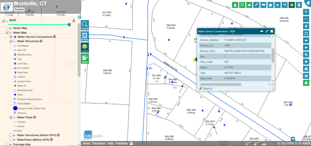
Montville, CT Water Pollution Control Authority (WPCA) hires CAI to perform GPS data collection and mapping for their 18 miles of public water system. CAI staff accompanied by WPCA staff, […]
Sandisfield, MA AxisGIS – Assessing Dynamic Map Layers and Editor Service

Sandisfield, MA contracts with CAI Technologies to create Assessing related data layers as well as configure AxisGIS Editor and ArcGIS Field Maps for the Highway Department. Taking advantage of the […]