New Boston, NH Parcel Remapping Project
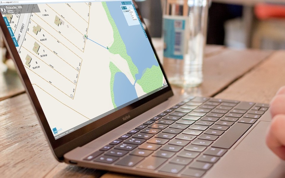
New Boston, NH has selected CAI Technologies to perform a Town wide parcel remapping project. CAI shall perform record research and recompile each of the Town’s parcels using the most […]
Old Orchard Beach, ME ArcGIS Online Hub Site
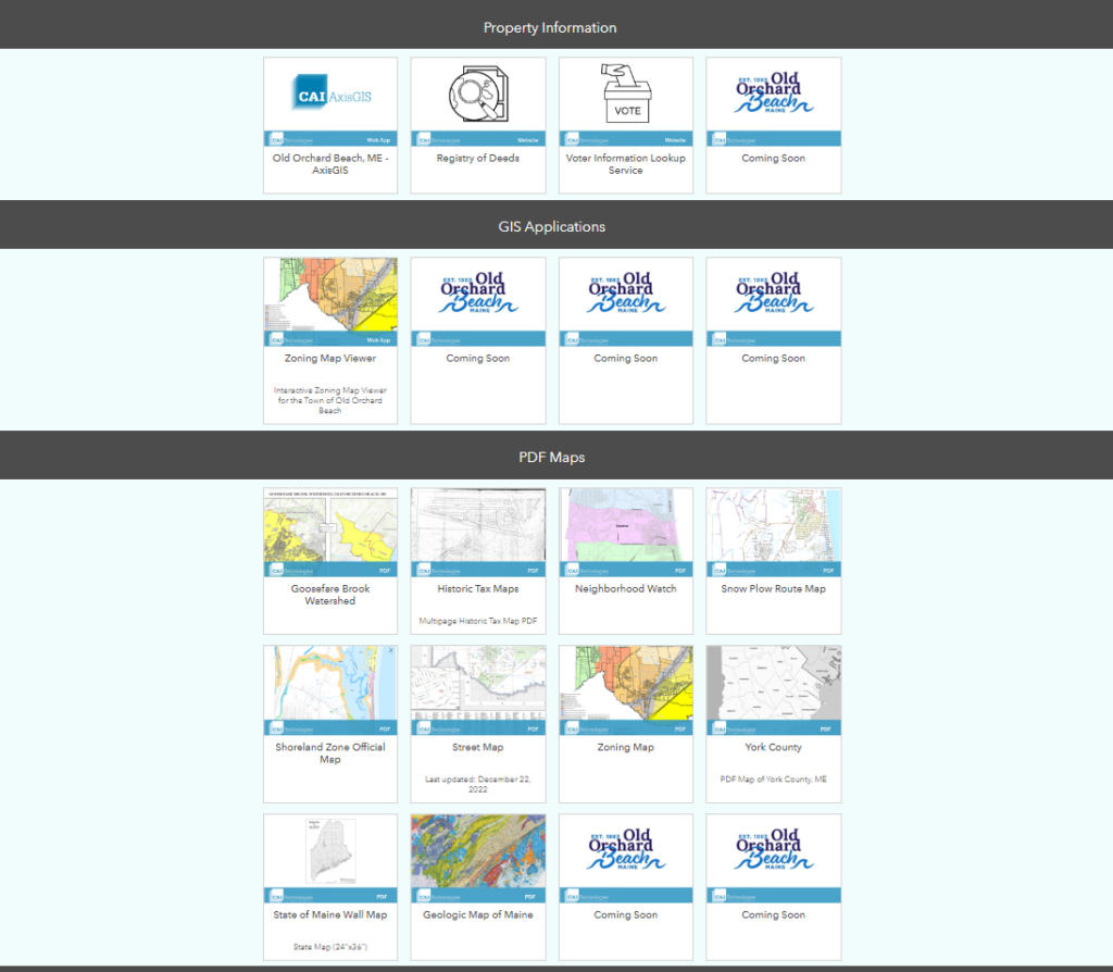
Old Orchard Beach, ME ArcGIS Online (AGOL) Hub site. CAI recently configured an AGOL Hub site for the Town. This webpage is now the landing spot for all things mapping […]
Arundel, ME AxisGIS Online GIS Hosting
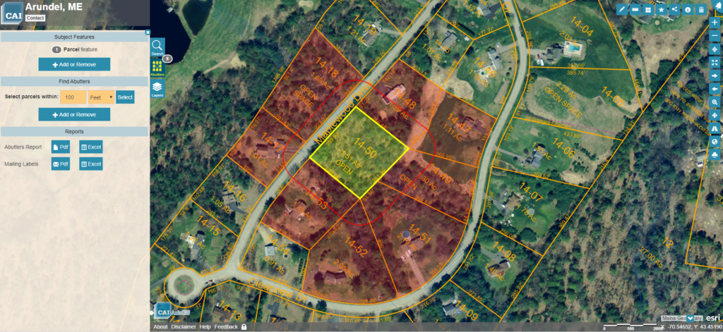
Arundel, ME has hired CAI to host the Town’s GIS data using our AxisGIS platform. AxisGIS is an advanced but yet simple and easy to use web based GIS service […]
Windham, CT Water Works Lead Service Line Inventory
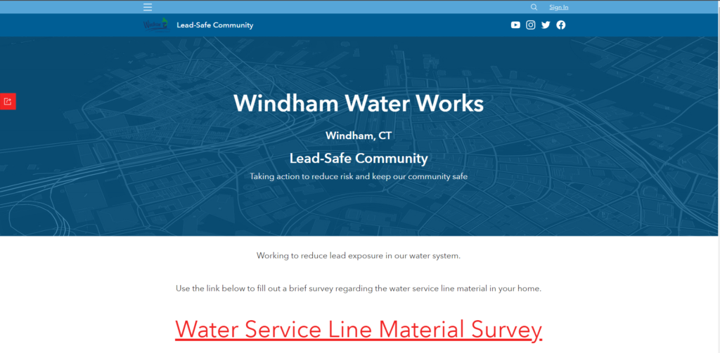
Windham, CT Water Works (WWW) recently contracted with CAI to configure ESRI’s Lead Service Line Inventory solution to support inspections required to meet the Environmental Protections Agency’s (EPA) Lead and […]
Wells, ME Assessor’s Office AxisGIS Dynamic Layers
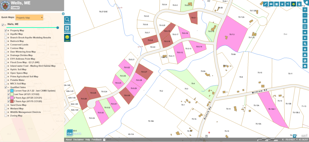
The Wells, ME Assessor’s Office recently contracted with CAI to configure Dynamic Layers in AxisGIS to support their ongoing effort to provide fair and equitable property tax assessments. The Town’s […]
CAI Technologies Spotlighted by eSpatially New York
eSpatially New York provides perspectives on the Goespatial community in the Empire State and beyond. Check out the GeoSpatial Business Spotlight on CAI Technologies. Thank you Sam! https://espatiallynewyork.com/